On this page:
Tipping buckets and rain data
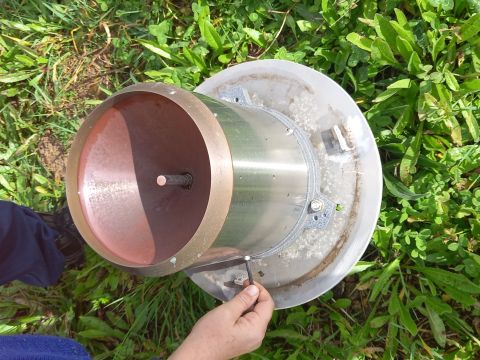
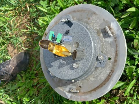
Tipping bucket rain gauges are the primary rainfall instruments in the Regional Water Monitoring Partnership (RWMP). These rain gauges direct rain from a funnel into two small brass buckets mounted on a central pivot.
Each bucket can hold a known amount of water before the pivot tips over. Every tip sends an electronic pulse from the rain gauge to our data logger.
For the majority of RWMP rain gauges, a bucket tip equals 0.2mm of rainfall. Millimetres is used for rainfall units as 1mm of rainfall equates to 1 litre of rain per square metre.
Rainfall data extracts look a little different from other continuous time series data. Instead of recording rainfall at routine intervals, every bucket tip is recorded. Most continuous data traces log every 15 minutes, but a site may go weeks without recording a drop of rain.
Rainfall site selection
General considerations
The RWMP aim is to install monitoring sites in accordance with National Industry Guidelines for hydrometric .
For rain gauges, this means three key things need to be considered: site location, site purpose, and site exposure.
- Location: weather direction, rain or snow, rainfall intensity, topography, current and future land activities, or developments need to be considered. It is important to ensure that the site is representative of local conditions.
- Site purpose: the primary site purpose could simply be for rainfall data colection. In addition, the purpose could be to combine rainfall data with an existing stream gauge.
- Site exposure: rainfall sites should be clear from vegetation from the ground (e.g. bushes/grass), and from above (trees). Sites should be clear from buildings and structures. Ideally, sites should be 300mm from the ground to reduce the effect of wind on rain data. Too low = splash from the ground. Too high = wind speeds increase with height.
Across the RWMP there is balance struck between data quality, cost, and site conditions. Sometimes a rain gauge is installed in conditions that don’t meet all the National Guidelines criteria.
Some sites have a long-term period of rain fall record that may pre-date current standards. This means that a site could have a rain gauge installed in conditions that may not be up to current standards but were the best available options at the time.
Detailed considerations
Location
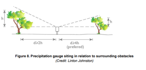
Rain gauges sited near buildings, solid fences and trees can have serious errors in rainfall totals. The distance of the gauge from buildings, trees or other objects should be at least twice the height of the obstruction, and preferably four times the height. For instance, the gauge should be more than 10 metres from a house 5 metres high and more than 30 metres from the nearest branches of a tree 15 metres high. The gauge should also be in a place where it will not be disturbed by people, animals, or vehicles.
Height
Having decided on where to locate the rain gauge, the next decision is the height. As the height of the rain gauge above ground is increased, the influence of the wind becomes more important (because the speed of the wind generally increases with height above the ground). This may increase the error associated with the measured rainfall. The rain gauges installed by the Bureau of Meteorology have the top of the collector 0.3 metre above ground level.
Rain gauge
The rain gauge opening should be horizontal, and the grass and vegetation around it should not be allowed to grow more than a few centimetres high. The rain gauge should be securely fastened so that it does not blow over in strong storms.
Conclusion
It may not always be possible to meet these criteria, particularly when the primary purpose of a shared site is to measure other parameters such as surface water discharge. Under these circumstances site selection requirements described in other sections may take precedence and govern site selection. If precipitation site criteria are not met, precipitation data for that site will be of reduced scientific acceptability. Exceptions to criteria shall be clearly documented and identified within metadata. To obtain precipitation records that are consistent over time and comparable between sites, standard procedures which apply to all sites shall be written and followed for site establishment and site operations.
Reviewed 11 June 2024