Slightly different methods are used to calculate the level of groundwater relative ground level or relative to sea level.
Water level is inferred by relating the hydrostatic pressure measured from the sensor to the distance between measuring point and reference point, or the length of cable. This is known in the data portal as Depth below measuring point. In non-flowing bores the reference point may be the top of the protective cover, or the top of the internal casing. In flowing bores, the reference point may be the artesian pressure connection point at which a pressure reading is recorded.
Depth below natural surface is the inferred depth of water below the ground at that location, or level to which it would rise if not confined under pressure (hydraulic head).
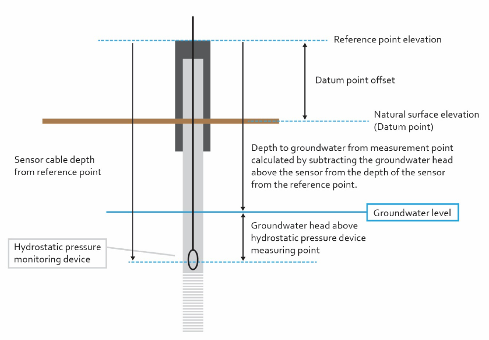
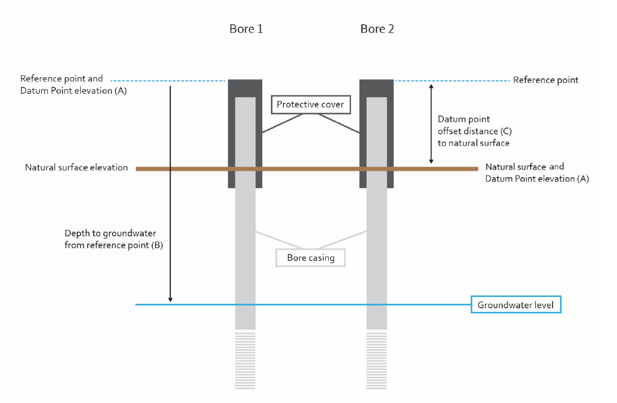
Bore water level AHD, the elevation of groundwater in relation to sea level, is calculated by relating to a known datum.
Datum are points that have a surveyed and accurately recorded elevation above Australian Height Datum, in metres (mAHD). They are used to convert a measured groundwater level to a groundwater elevation in mAHD. In most cases, our State Observation Bore Network (SOBN) reference points are already surveyed to mAHD. Where the reference point is the top of casing and datum is the same, groundwater elevation can be calculated by subtracting the groundwater level (depth to groundwater) from the datum mAHD elevation.
Sometimes the datum point and the reference point are different (e.g. a reference point is at the top of the casing and datum point is surveyed at the ground surface). In these cases, an offset will need to be applied when calculating the groundwater elevation. The offset will be the distance between the reference point and the datum point. Groundwater level elevation in mAHD may be calculated by subtracting the groundwater level (depth to groundwater) from the datum point elevation plus the offset distance.
To understand in more detail please refer to National Industry Guidelines for hydrometric monitoring 2019, Part 2
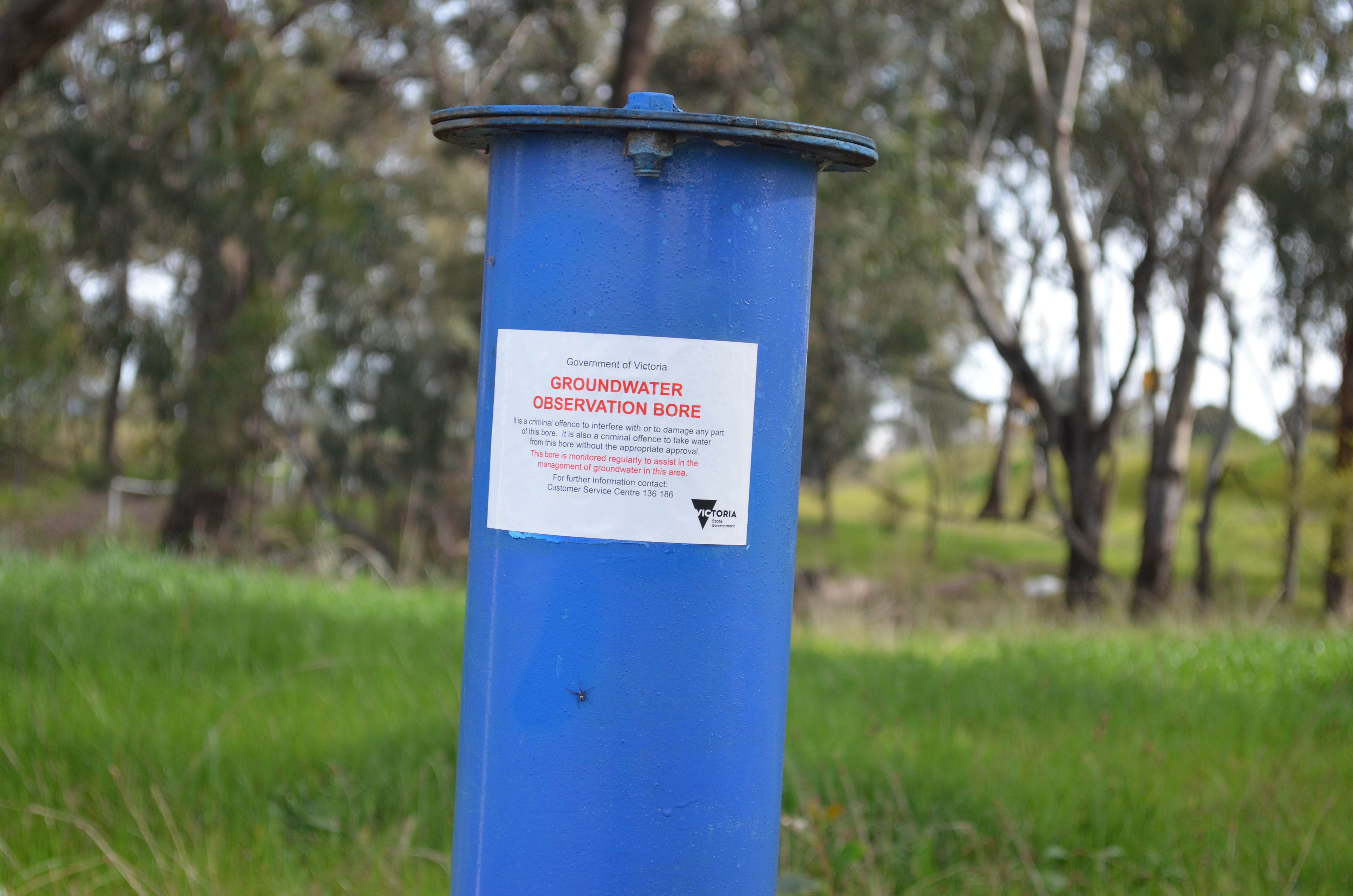
Reviewed 11 June 2024